MAP OF PHUKET ISLAND
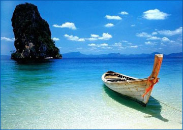
Located approximately 862 kilometers south of Bangkok is Phuket, Thailand's largest island, which is often dubbed as the pearl of the Andaman, or the pearl of the south. Its natural resources- rocky peninsular, limestone cliffs, white powdery beaches, tranquil broad bays and tropical in-land forests contribute to making it the South's wealthiest, busiest, most visited and most popular island and province.


Nestled in the tropical zone off the west coast of the southern part of Thailand in the Andaman Sea and the Indian Ocean, the province covers an area of approximately 543 square kilometers (excluding small islets). It is estimated that Phuket Province covers an area of approximately 590 square kilometers if its 39 other small islands are included. The islands total length, from north to south, is estimated at 48.7 kilometers and approximately 21.3 kilometers wide.
Phuket borders on Phang-nga Province to the north. The other 3 sides are encircled by the Andaman Sea the place where many of the best diving sites are located. The island is connected to Phang-nga Province by Sarasin Bridge and Thep Krasattri Bridge.
Staying on the island is easy, as there are only two seasons in a year the rainy season (May to October) and the hot season (November to April). Visitors are not recommended to travel to Phuket between September and October as they are the wettest months. The best period for a visit, however, is from November to February, when it is possible to see the clear blue sky, feel the fresh sea breeze and marvel at the crystal clear water while lying on powdery, palm-fringed beaches. Average temperatures ranges between 23°C and 33°C.
Phuket's topology is exceptional with 70 percent of its area covered with mountains which stretch from north to south and the remaining 30 percent being plains located in the central and eastern parts of the island. The island does not have any major rivers except for a total of 9 brooks and creeks.
Phuket is divided into 3 administrative counties namely Amphoe Muang, Amphoe Thalang and Amphoe Kathu.
Phuket has a lot more to offer its visitors other than its natural heritage sea, sand, sky, beach, forest, and world renowned diving sites. Sino-Portuguese architecture casts its spell delighting travelers to the city, while Phuket-style hospitality has never failed to impress visitors from all walks of life. In addition, accommodations ranging from world-class resorts to tropical-style bungalows have warmly catered to the different needs of travelers. For seafood lovers, there is a lot more to sample than just Phuket's famous lobster. Altogether, these characteristics have made Phuket a truly unique destination.
History of Phuket
Most geologists believe that the area known as Phuket today was once a cape that extended into the Andaman Sea. Geographical formations gradually changed the capes location, finally detaching it from the mainland.
A famous Greek philosopher, Claudius Ptolemy, was the first person who mentioned the cape in his book written in the year 157. The cape was locally referred to as Jung Ceylon, which was located between latitudes 6 N and 8 N (the present site of Phuket Island). Natives called the place Cha Lang, which evolved to Tha Lang the name of the main town to the north of the island.
As a perfect stopover sheltering traders from monsoons, Jung Ceylon welcomed merchants from India, Persia, Arabia, Burma, China and also Siam. During the 16th century, the island was also a popular trading port for tin with Portuguese, Dutch, English and French traders flocking to the island. This contributed to making the development of mining so unprecedented. Chinese businessmen and miners later migrated to Phuket and soon enjoyed thriving business wealth.
Apart from serving as a meeting point for traders from Europe, Central Asia and China, Phuket also attracted ambitious immigrants, especially those from Portugal and China, to work in the tin mines. With its colorful history, visitors admire the Sino-Portuguese style architecture in the city especially those buildings located along the Thalang and Yaowarat Roads.
Thalang town was surrounded by Burmese troops who invaded the coastal area in 1785. It was under the leadership of Chan, the widow of the governor, and her sister, Muk, who united local residents and successfully fought and drove the invaders out of Phuket. It took over 30 days for the defending troops of Phuket, under the command of Chan and Muk, to claim their victory. As a result of such heroic deeds, noble titles were granted to Chan and Muk as Thao Thep Krasattri and Thao Si Sunthon respectively. To honor them, a monument was established at Tha Ruea Intersection, 12 kilometers to the north of Phuket City in 1966. They are still highly respected by Phuket residents even today.
However, 24 years later, the Burmese succeeded in seizing Thalang causing many local residents to flee to Phang-nga and Krabi. In 1825, some of them returned to re-establish a town and established a rice farming community. On the other hand, the area to the south of the island (Phuket City today) was developed and became a tin trading center.
When Phuket was elevated to a town in 1850, it attracted more immigrants from Thalang and nearby communities. In 1894, Phuket was promoted to be a Monthon administrative unit under the supervision of the central administrative body (located in Bangkok).

In 1902, Phraya Ratsada Korsimbi, a Sino-Thai businessman who contributed to developing the modern city of Phuket was appointed Governor of Phuket. He also helped to improve the welfare of local residents and set up the market system in the countryside. In 1916, Phuket became a province.
The tin mining industry has gradually failed to generate economic growth in Phuket, especially after 1985 when the price of tin fell by half. However, with its natural resources, Phuket later emerged as a tourist destination with great potential. This polished pearl of the Andaman is truly a destination that provides visitors with memorable experiences.
The islands long history has shaped the distinctive Phuket of the present with its diverse ethnic groups, culture, architectural influence, and fine cuisine. With approximately 35 percent of the population being comprised of Thai-Muslims, it is possible to see an equal number of Wats (Thai temples) located next to Mosques.


